GIS Lookup: Detailed Data Layer Listing
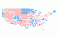 Title: "109th Congress (layer)" (2006) Title: "109th Congress (layer)" (2006)Description: 109th Congress (layer) is a symbolized display presentation of the United States 109th Congressional Districts data set. The geographic and attribute data for United States 109th Congressional Districts are symbolized to create the layer. All features are uniquely symbolized based on the PARTY attribute. Features are labeled based on the NAME attribute. | ||||
| Keywords and Themes: Congress, Congressional Districts, House of Representatives, | ||||
| Filename Prefix: 109th Congress.lyr | ||||
| ||||
| Mapped Drive Folder: /esri2006/data_maps/usa/census/ | ||||
| Total size of data files: | ||||
| Data Type: ESRI LYR - See Description for required data set | ||||
| Feature Type: | ||||
| Coordinate System: | ||||
| Datum: | Map Units: | |||
Spatial Extent: United States, Puerto Rico | ||||
| Source Scale: 1:1,000,000 | ||||
| Scale Note: Largest scale when displaying the data: 1:1,000,000. | ||||
Created by: ESRI | ||||
| Released by: ESRI; ESRI International Distributors | ||||
| Content Date: varies | ||||
| Published Date: 20061001 | ||||
Collection Name: ESRI® Data & Maps 2006 | ||||
| Physical Location: Reference GIS Data Cabinet | ||||
| Call Number: G70.212 .E77 2006 | ||||
| Acquired Date: 20061122 | ||||
| Distribution Restrictions: http://www.lib.ncsu.edu/gis/esridm/2006/help/rdstrght.htm | ||||
Note: | ||||
Links to Metadata, Documentation, and Mapping:
Record ID: 2741_edm06 | ||||
Explore
Library Data Services
Learn About GIS
Can't find data you're looking for?
Contact a Data Services Librarian for help.